

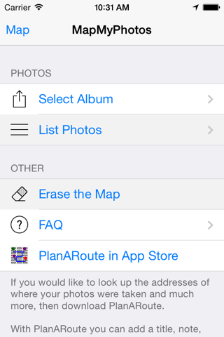


MapMyPhotos app for iPhone and iPad
Developer: John Kearon
First release : 27 Dec 2013
App size: 2.3 Mb
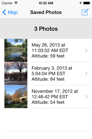
MapMyPhotos will plot all the photos in a selected photo album on a map. For each photo the Date, Time, Elevation and location on a map will be displayed.
For easier viewing, if you have numerous photos in an album, you can limit the display of photos by zooming the map to the desired geographic region and then displaying the photos in just that area. If many photos were taken in a single location, then those photos will be clustered onto a single pin which when selected will display a list containing the photos contained on that pin.
Use this app to recall when and where you took a photo.
If you would like to look up the addresses of where your photos were taken and much more, then download PlanARoute app for iOS.
With PlanARoute you can add a title, note, look up the address and create a tour or any multi-step journey from these photos. Both visual and written directions can be created from these photos and any other location you add to your journey.